-40%
GARMIN HXUS039R USA Coastal BlueChart G2 Map Chart on micro SD card 010-C1018-20
$ 22.17
- Description
- Size Guide
Description
Like new,shipped with
the MicroSD card and SD
card adapter
Coverage
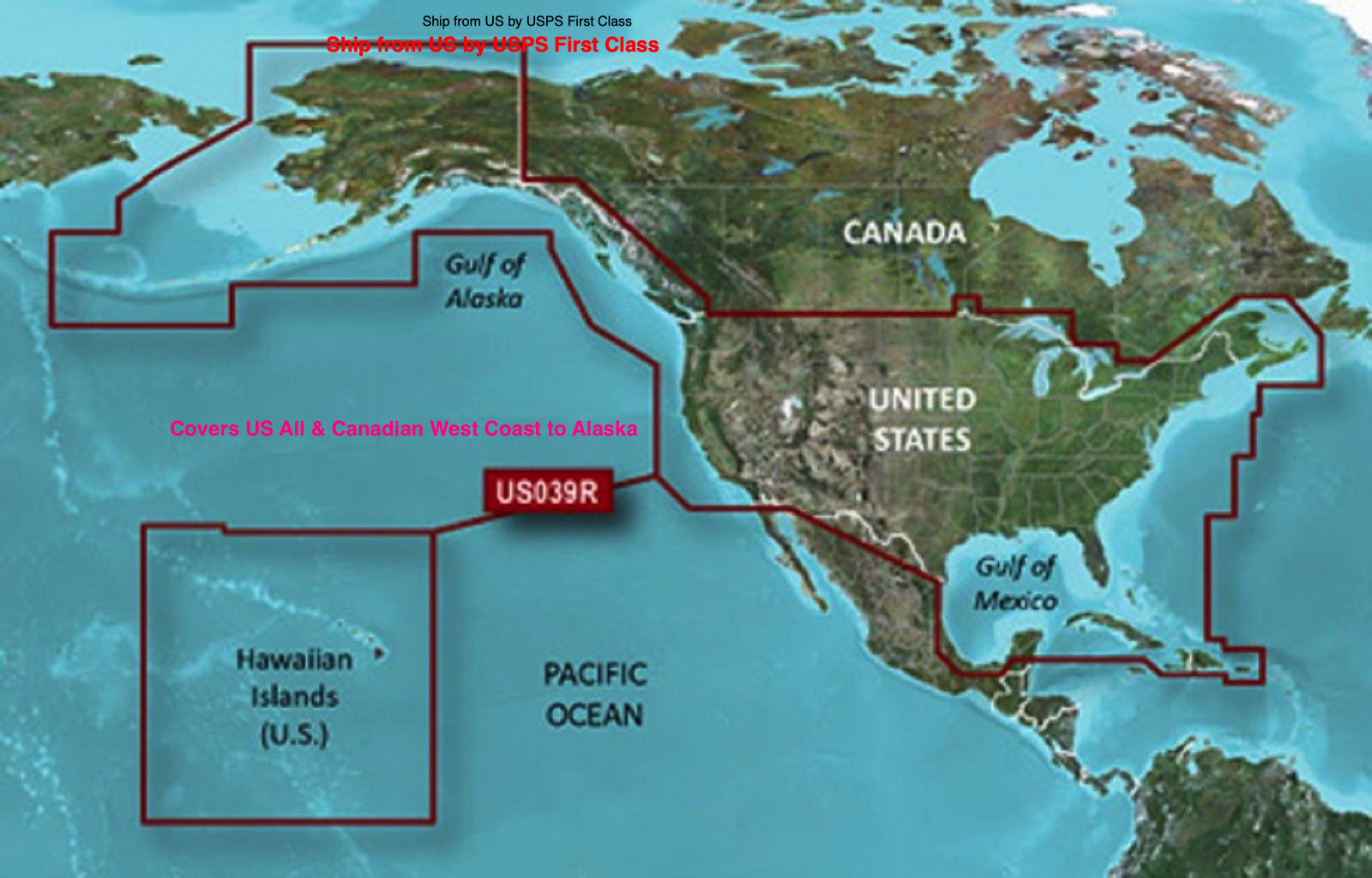
Provides detailed coastal coverage of the U.S. including the East Coast from the Canadian Border to Key West, FL; the Gulf of Mexico; Alaska; the West Coast from Puget Sound to the Mexican Border; Hawaii; the Bahamas; the Aleutian and Channel Islands; and major inland rivers. Also features general coverage of Canadian waters in the Inside and Outside Passages, Puget Sound, and the Great Lakes.
About BlueChart g2 Maps
Get a new perspective on navigation with BlueChart g2 marine cartography. This newly designed map data provides even more detail, dimension and graphical sophistication to a well-proven benchmark of marine navigation.
Featuring crisp labeling and an overall smoother presentation on your chartplotter display, the new generation of BlueChart g2 has numerous improvements to assist in marine navigation. In addition to the basic charts, tidal stations, currents, depth contours, IALA symbols, and included fishing charts, BlueChart g2 offers improved transitioning between zoom levels and more seamless continuity across chart boundaries.
BlueChart g2 also adds Safety Depth settings to let users select up to five values for specific depth contour intervals. And the fishing charts are designed to emphasize bathymetric contours with less visual clutter on the display. There?s also a choice of standard 2D direct overhead or 3D ?over the bow? map perspective views to make chart reading and orientation easier.
Realistic navigation features showing everything from shaded depth contours and coastlines to spot soundings, navaids, port plans, wrecks, obstructions, intertidal zones, restricted areas, IALA symbols and more
Smooth display presentation including seamless transitioning between zoom levels and more continuity across chart boundaries
Safety Depth settings lets you select up to five values for specific depth contour intervals
Fishing charts to focus on bathymetric contours with less clutter on the display
Choice of standard 2D direct overhead or 3D ?over the bow? map perspective to make chart reading and orientation easier
Compatible with following Garmin devices : 500 Aera, Alpha 100, Astro
220, 320,
Colorado
300, 400
, Dakota
20
echoMAP
42dv, 43dv, 44dv, 50dv, 50s, 52dv, 54dv, 70dv, 70s, 72sv, 73dv, 73sv, 74dv, 74sv, 92sv, 93sv, 94sv
Epix
GPSMAP
420, 420s, 421, 60CSx, 60Cx, 62, 62s, 62sc, 62st, 64, 64s, 64st, 76CSx, 76Cx, 78, 78s, 420, 420s, 421, 421s, 430, 430s, 431, 431s, 440, 440s, 441, 441s, 5008, 5012, 5015, 520, 5208, 520s, 521, 521s, 525, 525s, 526, 526s, 527, 527xs, 530, 530s, 531, 531s, 535, 535s, 536, 536s, 540, 540s, 541, 541s, 545, 546, 546s, 547, 550, 550s, 555, 555s, 620, 640, 720, 720s, 721, 721xs, 740, 740s, 741, 741xs, 820, 820xs, 840xs, 1020, 1020xs, 1040xs, 4008, 4010,4012,4208,4210,4212,5212,5215, 6008, 6012, 6208, 6212, 640, 7012, 7015, 7012, 7015, ,7212, 7215, 721xs, 7407, 7407xsv, 7408, 7408xsv, 7410,7410xsv, 7412, 7412xsv, 7416, 7416xsv, 7607, 7607xsv, 7608, 7608xsv, 7610, 7610xsv, 7612, 7612xsv, 7616, 7616xsv, 8008, 8012, 8015, 8208, 8212, 8215, 8500 Black Box, 8503 Black Box
Montana
600, 600t, 610, 610t, 650, 650t, 680, 680t
Nuvi
500, 550, 710
Oregon
200, 300, 400c, 400i, 400t, 450, 450t, 550, 550t, 600, 600t, 650, 650t
Rino
610, 650, 650t, 655t
Zumo
220, 350LM, 390LM, 550, 550LM, 660, 660LM, 665, 665LM
