-40%
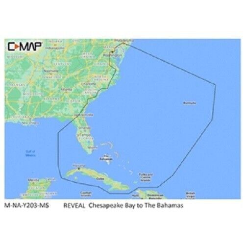
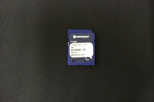
Cmap Reveal Chesapeake Bay To Bahamas Coastal M-NA-Y203-MS
$ 94.77
- Description
- Size Guide
Description
100% OriginalHigh Quality
Fast Shipping
CMAP Reveal
Brand New
GREAT Pricing
Fast Shipping
C-MAP Reveal NA-Y203 Chesapeake to Bahamas
C-Map Reveal Charts are the perfect compliment to your compatible Lowrance, Simrad and B&G Chartplotter or Plotter/Fishfinder combination unit. A top choice for fishing and diving enthusiasts the reveal charts provide ultra-high def images of structure, wrecks, isolated reefs and ledges. Detailed charts include full Max N+ vector navigation including high resolution Bathy, Custom Depth Shading, Genesis Layer and Satellite Imagery as well as detailed Marina and port plans!
Simple plug and play connection, just turn on the shaded relief setting in your compatible plotter and you are ready to access the details the REVEAL charts offer. C-MAP Reveal imagery replaces shaded relief data in selected areas with more accurate depth variations, revealing the best fishing and diving spots. C-MAP HRB Coastal data, Genesis social map data and satellite imagery can be overlaid on the standard vector charts and provide exception detail.
CMAP REVEAL Chesapeake Bay To Bahamas Coastal M-NA-Y203-MS
Shipping
We offer FREE shipping on all orders!
Your order will be sent within one business day of receiving payment (Monday-Friday) and you should expect to receive your unit one to four days later.
In the very unlikely event that your item is lost or damaged during post, then WE are responsible and will issue either a full refund or replacement.
Returns
You can return a product for up to 30 days from the date you purchased it.
Any product you return must be in pristine condition (the exact same condition as you received it). Everything must returned from the head unit to the mounting hardware. Items received in used condition (other than pristine) will be subject to a restocking fee. Units that have been installed and removed do not qualify as pristine.
100% Original
Good Pricing
Fast Shipping
C-MAP Reveal NA-Y203 Chesapeake to Bahamas C-Map Reveal Charts are the perfect compliment to your compatible Lowrance, Simrad and B&G Chartplotter or Plotter/Fishfinder combination unit. A top choice for fishing and diving enthusiasts the reveal charts provide ultra-high def images of structure, wrecks, isolated reefs and ledges. Detailed charts include full Max N+ vector navigation including high resolution Bathy, Custom Depth Shading, Genesis Layer and Satellite Imagery as well as detailed Marina and port plans! Simple plug and play connection, just turn on the shaded relief setting in your compatible plotter and you are ready to access the details the REVEAL charts offer. C-MAP Reveal imagery replaces shaded relief data in selected areas with more accurate depth variations, revealing the best fishing and diving spots. C-MAP HRB Coastal data, Genesis social map data and satellite imagery can be overlaid on the standard vector charts and provide exception detail.
CMAP Reveal
Brand New
GREAT Pricing
Fast Shipping
CMAP REVEAL Chesapeake Bay To Bahamas Coastal M-NA-Y203-MS
C-MAP Reveal NA-Y203 Chesapeake to Bahamas
C-Map Reveal Charts are the perfect compliment to your compatible Lowrance, Simrad and B&G Chartplotter or Plotter/Fishfinder combination unit. A top choice for fishing and diving enthusiasts the reveal charts provide ultra-high def images of structure, wrecks, isolated reefs and ledges. Detailed charts include full Max N+ vector navigation including high resolution Bathy, Custom Depth Shading, Genesis Layer and Satellite Imagery as well as detailed Marina and port plans!
Simple plug and play connection, just turn on the shaded relief setting in your compatible plotter and you are ready to access the details the REVEAL charts offer. C-MAP Reveal imagery replaces shaded relief data in selected areas with more accurate depth variations, revealing the best fishing and diving spots. C-MAP HRB Coastal data, Genesis social map data and satellite imagery can be overlaid on the standard vector charts and provide exception detail.
Shipping
We offer FREE shipping on all orders!
Your order will be sent within one business day of receiving payment (Monday-Friday) and you should expect to receive your unit one to four days later.
In the very unlikely event that your item is lost or damaged during post, then WE are responsible and will issue either a full refund or replacement.
Returns
You can return a product for up to 30 days from the date you purchased it.
Any product you return must be in pristine condition (the exact same condition as you received it). Everything must returned from the head unit to the mounting hardware. Items received in used condition (other than pristine) will be subject to a restocking fee. Units that have been installed and removed do not qualify as pristine.
100% Original
Good Pricing
Fast Shipping
C-MAP Reveal NA-Y203 Chesapeake to Bahamas
C-Map Reveal Charts are the perfect compliment to your compatible Lowrance, Simrad and B&G Chartplotter or Plotter/Fishfinder combination unit. A top choice for fishing and diving enthusiasts the reveal charts provide ultra-high def images of structure, wrecks, isolated reefs and ledges. Detailed charts include full Max N+ vector navigation including high resolution Bathy, Custom Depth Shading, Genesis Layer and Satellite Imagery as well as detailed Marina and port plans!
Simple plug and play connection, just turn on the shaded relief setting in your compatible plotter and you are ready to access the details the REVEAL charts offer. C-MAP Reveal imagery replaces shaded relief data in selected areas with more accurate depth variations, revealing the best fishing and diving spots. C-MAP HRB Coastal data, Genesis social map data and satellite imagery can be overlaid on the standard vector charts and provide exception detail.
